Garðabær history
Garðabær received market town rights in 1976, but the land of Garðabær has been inhabited since the time of settlement.
Garðabær Photo Gallery
The Garðabær photo gallery is published on the Garðabær photo website. There you can see images of nature, residential areas, human life, construction projects and cultural events related to the municipality's activities.
History of the settlement
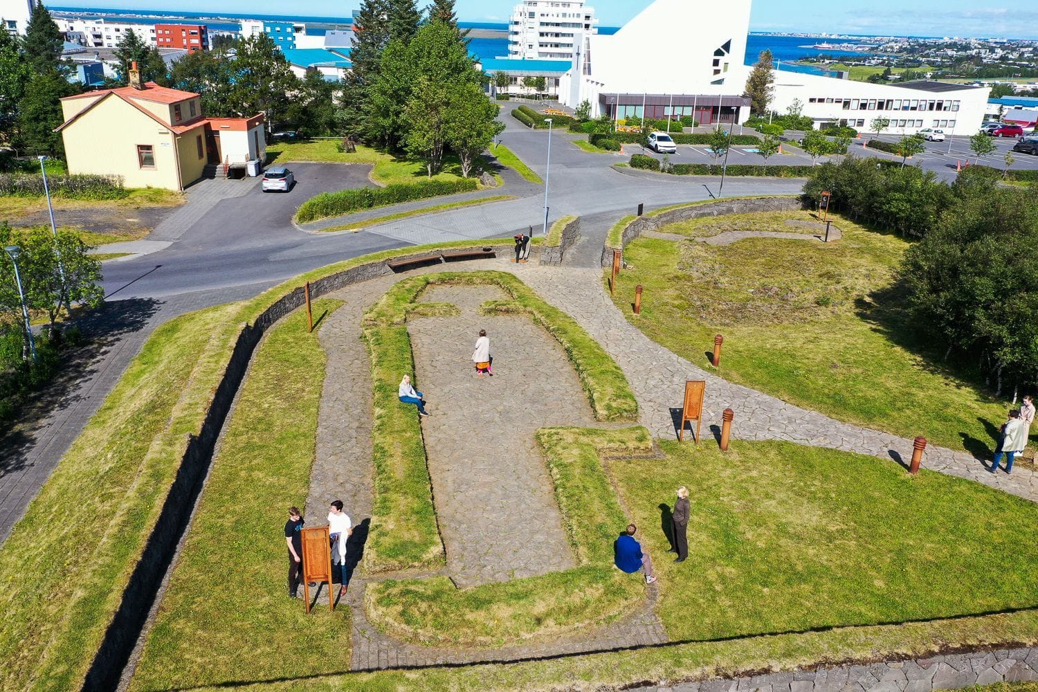
The land of Garðabær has been inhabited since the time of settlement. It is believed that the current territory of the town belonged to three people. The westernmost part was the land of Ingólfur Arnarson, the land around Vífilsstaður owned by Vífil, Ingólfur's kinsman, and the southernmost part was owned by Ásbjarn Özuarson, who lived at Skúlastaðir and Landnámi says that he received land between Hraunsholtslækjar and Hvassahraun, all of Álftanes. It is believed that Skúlastaðir was either where Bessastaðir is now or where the church site of Garðar on Álftanes is now, after which Garðabær is named. In 1994, relics of the farm Hofsstaðir were found in Garðabær, where the center of Garðabær is now. Archaeological excavations show that Hofsstaðir has been inhabited since the time of settlement and that there was a large farm there. Hofsstaðir is not mentioned in Landnáma and it is not known who lived there.
Garðahreppur 1878
During the National Socialist era, a district division was introduced in this country, and the land of Gardabær was then in Álftaneshrepp, which extended from Kópavogur in the north to Hvassahraun in the south. In 1878, Álftaneshrepp was divided into Garðahrepp and Bessastaðahrepp, and the settlement south of Hafnarfjörður then belonged to Garðahrepp. This division remained until Hafnarfjörður received market town rights in 1908. After that, Garðahrepp owned land on both sides of Hafnarfjörður, until 1959, when the boundaries of the municipalities were changed, but several changes have since been made to them.
Agriculture and fishing
The population of Garðahreppur decreased when Hafnarfjörður received market town rights and did not begin to increase again until the third decade of the 19th century. Agriculture, especially sheep farming, was the backbone of the economy, but there was also some fishing from Álftanes and there was, for example, a lot of roe fishing there in the spring. The largest farms were Vífilsstaðir and Hofsstaðir, but in Arnarnes there was also a very large farm, Litla-Arnarnes, and below Hafnarfjörðurvegar was the farm Lyngholt where a beautiful farm was run for a time.
The first urban plan in 1955
The first plan for Garðahrepp, which aimed to build an urban area there, dates from 1955, and it covered the area on both sides of Hafnarfjörður Road, from Arnarneslækur to Engidalur. According to the plan, settlements were built in Hraunsholt and Silfurtún. In 1960, the district was legalized as a trading post and had a population of 730, of which 690 were in the urban area, making it the most populous district in the country. After this, the urban area grew rapidly and for a time the population increase was the highest in any municipality in the country, but by the end of 1970 the population was almost 2,800.
Marketplace Rights 1976
Garðahreppur was added to the number of towns on January 1, 1976, and the population at that time was 4,108.
In 2013, the municipalities Garðabær and Álftanes merged, bringing the municipality's population to almost 14 thousand. By 2020, the population had reached 17,700 and exceeded 21 thousand by 2026.
The settlement in Garðabær is quite diverse, mostly low-rise, but in recent times more apartment buildings have been built and the density has increased, especially around the service center of the city center at Garðatorg . In line with the development, the architecture of the municipality is characterized by the emphases of each era and in the municipality you can find many well-known landmarks and beautiful buildings, including the town hall tower at Garðatorg , Garðakirkja in Garðahverfi, Vífilsstaðir, Bjarnastaðir and the presidential palace at Bessastaðir.